Right in the heart of Chattanooga, our cozy getaways at Wauhatchie Woodlands and Mountain’s Ledge provide the perfect starting point for exploring this amazing city and its nearby waterfalls. The nearest waterfall is a quick 8-minute drive from downtown Chattanooga, giving you the flexibility to enjoy the falls and still have plenty of time for an early dinner in the city. Even the waterfall that’s furthest away won’t keep you on the road for too long – it’s just an hour’s drive. So, whether you’re looking for a quick escape or a mini road trip, these waterfalls are all well within reach.
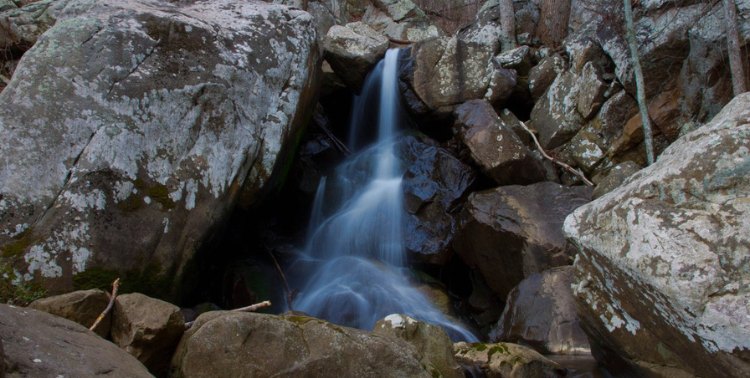
glen falls
1.2 miles | out and back | moderate
Looking for a waterfall that is just a short drive from downtown Chattanooga? Then let me introduce you to Glen Falls; not only is it accessible, but it’s worth the visit. Glen Falls is on a manageable 1.2-mile out-and-back trail near Lookout Mountain. The best part is that it’s only a 41-minute hike, and every minute is packed with beauty and adventure.
As you navigate the trail, you will be greeted by little surprises: several smaller falls that build the anticipation of the grand reveal. As you start your ascent to the falls, you will navigate through stone stair paths and climb through a stone door carved right into the rock, leading you to a beautiful overlook.
Even though this trail is short, it is nothing short of being full of surprises. Just beyond the stone door, you’ll discover a bridge that leads to a small pool, the perfect spot to take a break and cool off.
When you arrive, you’ll be met by the sight of a gentle stream of water cascading over rocky terrain. The flow of the falls changes depending on the weather, so it’s likely you will have a unique experience every time. Whether it is a full cascade or a gentle trickle- you will have a memorable experience.
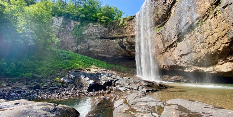
lula falls
3.2 miles | loop | moderate
Prepare to be blown away by the beauty of Lula Falls. This stunning 120-foot freefall is tucked away within the Lula Lake Land Trust. Since its dedication to preserving the Rock Creek Watershed in 1994, this area has become a beloved place for nature enthusiasts. With 8 miles of winding trails, a multitude of overlooks, and hardwood forests, it’s a place where you can’t help but get lost in the beauty of it all.
To experience the magic of this place, it is crucial to note that the Lula Lake Land Trust is only open to the public on select days of the week. So it is important to reserve your visit in advance. But let me tell you, once you’ve secured your reservation, get ready for an unforgettable experience!
The access point leading to the falls might involve a bit of a workout, think steep terrain, and more than a fair share of stairs. But trust me when I say every step is worth it. The waterfall truly comes to life when you reach the bottom of the gorge. You will be rewarded with the most breathtaking views, which will have you forgetting about the journey there. So bring your sense of wonder and get ready to be rewarded by the beauty of this area.
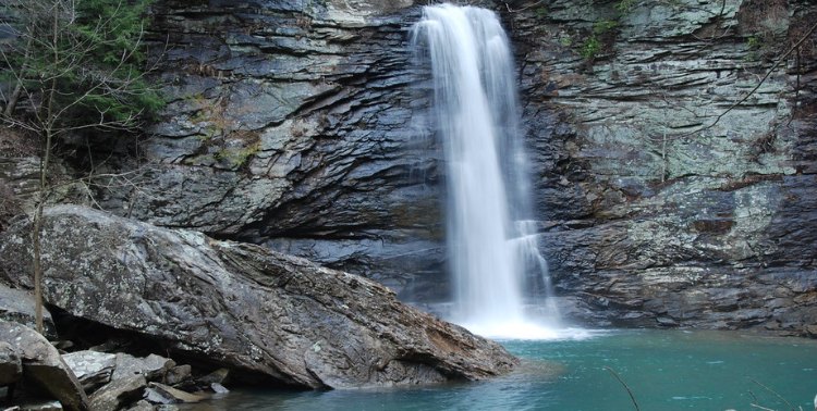
rainbow falls
2.6 miles | loop | challenging
Prepare for an enjoyable adventure to this 80-foot waterfall located minutes from downtown, which offers easy access to Signal Point and beautiful views of the Tennessee River Gorge.
You begin the hike at the Rainbow Lake Trailhead, where you make your way along the first leg of your adventure to Rainbow Lake. This section is a breeze and the perfect trail for all levels of hikers. Once you arrive at the lake, you will find that it is an ideal spot to take a break, enjoy a snack, and take in the surroundings.
The real adventure continues past the lake when you continue your trek towards Rainbow Falls. Continue to follow the trail until you reach a swinging bridge. However, don’t cross it if you want to head to the falls – stay on the path marked by white trail blazes and head towards Signal Point. When you reach another smaller bridge, cross it, and you will be a few minutes from the path to the falls.
The real challenge begins as you make your final descent down to the falls. It is a bit rugged and not as well-maintained, but well worth the effort. The views of the falls from the bottom of the trail are incredible and provide you with a relaxing area to rest after the strenuous hike.
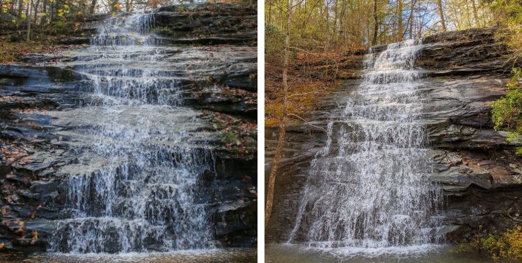
blowing wind falls
3.6 miles | loop | moderate
Come ready to be blown away by the Blowing Wind Falls. This majestic 30-foot waterfall is located in the Prentice Cooper State Forest. It can be accessed by a 3.6-mile roundtrip on the Ritchie Hollow Trail, considered a moderately strenuous hike.
To begin your ascent to the falls, you can access the trailhead located just above the gravel parking lot across from the Pot Point Cabin. On the way to the falls, a majority of the trail is rocky and climbs at a steady incline. Don’t let this stop you, as you will become captivated by the mature hardwood forest surrounding the trail.
As you reach the end of the trail, the breathtaking falls will be revealed to you, flowing over multiple cascades and surrounded by rocky overlooks covered in greenery. You will have reached a 650 ft elevation gain and can enjoy the peaceful surroundings before heading back.
If you are feeling adventurous, you can continue up the trail for another mile or so, where you will reach the Davis Pond campground. Either way, this trail provides you with a great workout and is well worth it for the views.
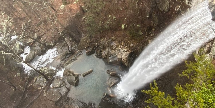
falling water falls
0.3 miles | out and back |easy
Nestled within a 136-acre natural area in Hamilton County, Falling Water Falls is a true gem. This 110-foot waterfall gracefully flows over the edge of the Cumberland Plateau. As it plunges into the scenic gorge of Falling Water Creek, it creates a display of cascades and moss-covered boulders, providing an invitation to enjoy the natural beauty of the area.
The Falling Water Falls trail takes you 0.3 miles out and back to access the top of the falls. The walk is fairly easy and very short, making it well worth the views at the end. Once you reach the falls, you can see them plunging into the Creek Gorge below while taking in the surrounding beauty seamlessly. The lush forestland surrounding the falls provides the perfect backdrop.
The top of the falls are located in the small but charming town of Walden, while most of the natural area extends beneath the falls in Soddy Daisy. The blend of such natural beauty and urbanization shows how unique this fall’s location is. You can enjoy the peaceful seclusion of the falls while being minutes away from a bustling city.
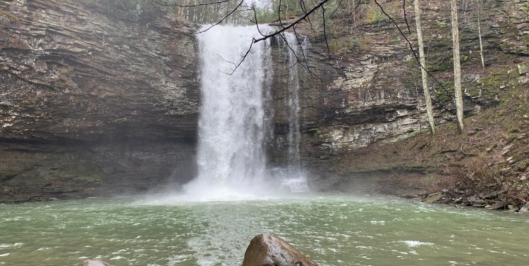
hemlock and cherokee falls
1 mile | out and back | easy
Located within the picturesque Cloudland Canyon State Park, perched atop the western edge of Lookout Mountain on the Cumberland Plateau, you will find yourself intrigued by the falls. On the Waterfall trail, you will find not one but two waterfalls to explore!
Your journey will begin on an easy, paved path that eases you into all the area has to offer. As you continue on the trail, you will encounter a 600-step staircase, but don’t let that intimidate you, as it leads to both beautiful falls. As you hike to the falls, you will be surrounded by beautiful scenery and the sound of the Daniel Creek trickling along your path.
The first of these is Cherokee Falls, a 60-foot waterfall conveniently located only 0.3 miles from the trailhead. As you become closer to the falls, you will see the falls peeking out from between the towering trees. The adventure doesn’t stop there!
Another 0.5 miles from the trailhead, you will find Hemlock Falls, standing at 90 feet tall. The trail is very well-marked, so it is easy to explore and get lost in the beauty without really getting lost! Once you reach the falls, you will find an observation deck that is the perfect place to stop and eat while viewing the falls before your return trip.
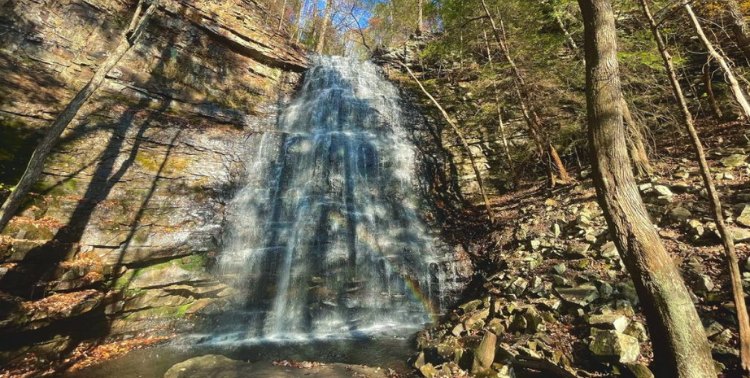
denny cove falls
2.8 miles | out and back | moderate
Tucked away in Denny Cove within the South Cumberland State Park, you will find a captivating 70-foot waterfall. This area is known for its numerous rock-climbing opportunities, attracting a large community of climbers. However, this area offers an escape for hikers as well.
To reach Denny Cove Falls, you begin with a 0.5-mile walk along the plateau, where you can soak in the scenery. The hard part of the trek comes up as you descend the side of the plateau for about a mile to reach the falls.
As you make your way along the trail, you will notice a vast cliff on the north side, running parallel to your path. This terrain is mild, so many levels of hikers and adventurers can explore this area. As you near the waterfall, the incline will increase, creating a sense of anticipation before you can see it. At the end of the trail, you will find yourself in a small opening with direct views of the falls. This is a destination that welcomes all and is worth every step!
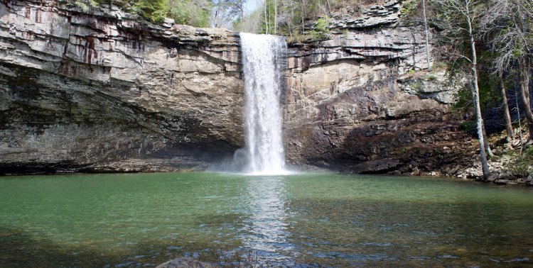
foster falls
0.6 miles | out and back | moderately challenging
Foster Falls is nestled along the Fiery Gizzard Trail and offers an accessible and enjoyable hiking experience. The journey to the falls is short and simple, making it perfect for hikers of all skill levels.
The trail forms a loop totaling 2 miles, making it perfect for a quick trip that still offers great views. The trail makes a steep descent to the bottom of the falls, where you will find a spacious creekside and a refreshing pool for swimming. This is the perfect spot to take a dip and cool off or just relax and soak in the surroundings. From the base of the falls, the trail wanders along the base of a rock climbing wall. Once you have enjoyed the area, head back up to the top of the falls, where you will encounter a trail that lines the rim of the canyon, offering you a unique view of the falls from above.
If you are feeling like the short and simple trip isn’t for you, you’re in luck. The trail lines the entire rim of the canyon, which stretches about 12 miles one way, perfect for a more extensive adventure. So whether you are seeking a stroll or an extended adventure, Foster Falls is the place for you!
laurel falls
3 miles | out and back | moderate
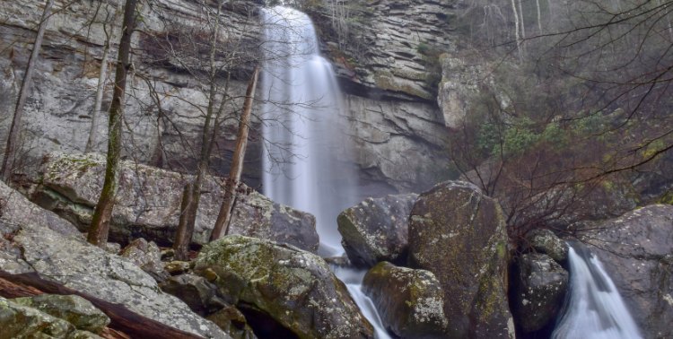
Get excited for a journey to Laurel Falls in the Laurel Snow State Natural Area. Just minutes from Dayton, Tennessee, this scenic waterfall is a nature lovers’ dream, with an impressive 80-foot drop sure to leave you in awe.
The adventure to this adventure begins with a 1.5-mile trek, guiding you along the path that follows the Richland Creek upstream. You will start on a level and easy-going stretch that used to be an old paved road. About 1 mile in, just before you reach the reservoir, the trail kicks it up a notch. It begins to climb steep and narrow, adding just a bit of difficulty. Continue another quarter mile until you reach a charming bridge that spans across Laurel Creek.
The last stretch of the hike is where the fun begins. You will be faced with a steep climb and several switchbacks that lead you right to the base of Laurel Falls. You are rewarded with the view of the 80-foot plunge with a series of cascades.
So, if you are looking for scenic beauty, a thrilling hike, and some fun, you will want to visit!
And there you have it, a journey through the world of waterfalls in and around Chattanooga. Whether you are a seasoned hiker, a nature enthusiast, or someone who simply seeks adventure, these waterfalls have something for you. Each of these waterfalls promises a new adventure, a fresh perspective, and unforgettable memories. We hope you leave this blog feeling inspired to embark on your own waterfall-chasing adventures. So grab your waterfall-chasing essentials and get ready to have a good time!
Tags: Chattanooga, Outdoor Adventures, Waterfalls