


Escalante
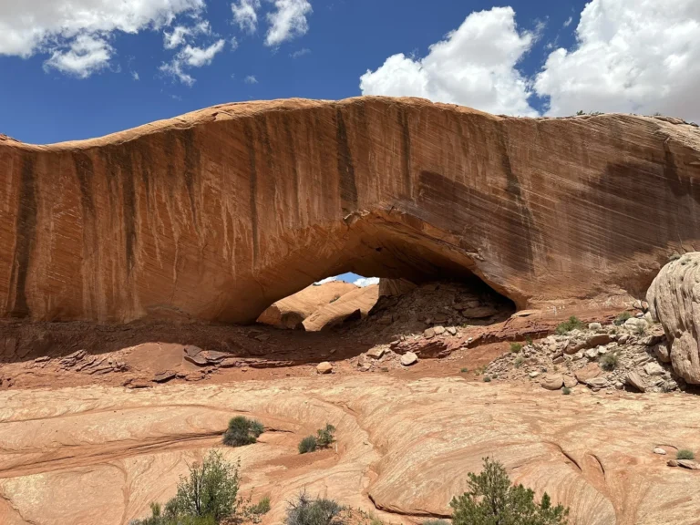
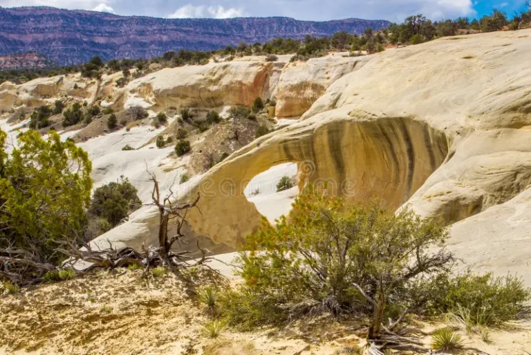
Phipps Arch
Phipps Arch is a massive sandstone arch perched high above Phipps Wash in Grand Staircase-Escalante National Monument. The challenging hike offers solitude and panoramic views of the surrounding canyons. Access Information: Trailhead: Escalante River Trailhead, 14.6 miles south of the UT-12/Burr Trail Road junction Coordinates: 37.7390° N, 111.4240° W Hike Distance: Approximately 8.8 miles round trip Access: Moderate to strenuous hike; river crossings required Phone: (435) 826-5499 (Escalante Interagency Visitor…
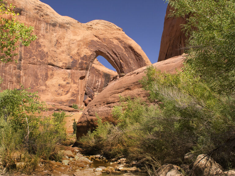
Sam Pollock Arch
Sam Pollock Arch is a secluded sandstone arch located in a remote canyon off Hackberry Canyon. The challenging hike involves boulder scrambling and offers a sense of discovery for intrepid explorers. Access Information: Trailhead: Hackberry Canyon Trailhead, off Cottonwood Canyon Road Coordinates: 37.3139° N, 111.9435° W Hike Distance: Approximately 6 miles one way Access: Difficult hike with route-finding; GPS recommended Phone: (435) 826-5499 (Escalante Interagency Visitor Center)
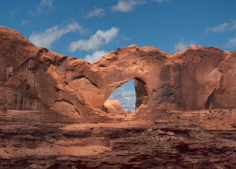
Broken Bow Arch
Broken Bow Arch is a striking natural arch spanning nearly 100 feet, located in Willow Gulch. The 4-mile round-trip hike offers scenic views of towering sandstone walls and a chance to explore a serene desert canyon. Access Information: Trailhead: Willow Gulch Trailhead, accessed via Hole-in-the-Rock Road Coordinates: 37.3249° N, 111.0227° W Access: 4-mile round-trip hike; trail may involve stream crossings Phone: (435) 826-5499 (Escalante Interagency Visitor Center)
Stevens Arch
Stevens Arch is a massive natural arch spanning 220 feet, perched high above the Escalante River near the confluence with Coyote Gulch. Its remote location offers solitude and breathtaking views, making it a rewarding destination for experienced hikers. Access Information: Trailhead: Crack-in-the-Wall Trailhead, accessed via Hole-in-the-Rock Road Coordinates: 37.3739° N, 111.0342° W Access: Approximately 8-mile round-trip hike with 1,500 ft elevation gain Phone: (435) 826-5499 (Escalante Interagency Visitor Center)
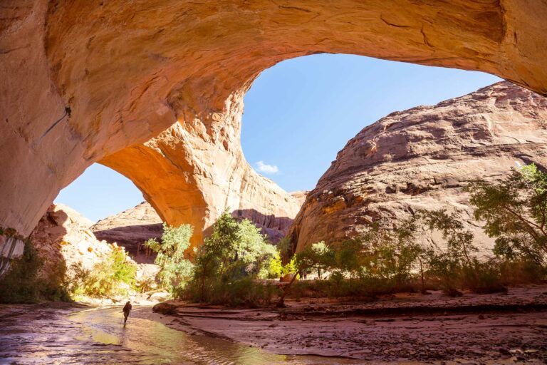
Jacob Hamblin Arch
Jacob Hamblin Arch is a massive sandstone arch located in Coyote Gulch, known for its impressive span and picturesque setting. It’s a popular destination for backpackers exploring the Escalante River region. Access Information: Location: Coyote Gulch, Grand Staircase-Escalante National Monument Coordinates: 37.3822° N, 111.0483° W Access: Accessible via a multi-day backpacking trip; permits required Phone: (435) 826-5499 (Escalante Interagency Visitor Center) Visit Website
Cedar Wash Arch
Cedar Wash Arch is a natural sandstone arch situated above a scenic wash, offering visitors a short hike with rewarding views. The trail provides a peaceful experience away from more crowded attractions. Access Information: Location: Southeast of Escalante, Utah Directions: From Escalante, drive east on Highway 12 for 4.9 miles to Hole-in-the-Rock Road. Turn right and drive 3.4 miles to Cedar Wash Road. Turn right and continue 3.6 miles to…
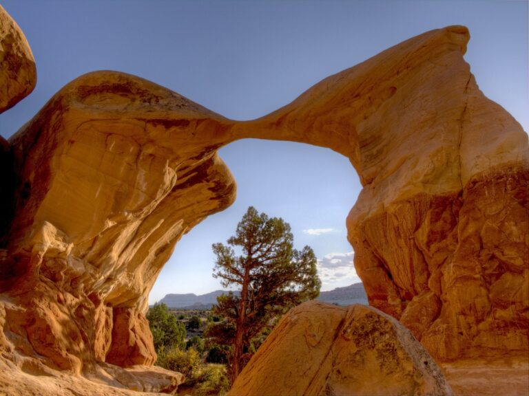
Metate Arch
Metate Arch is a delicate sandstone formation located within the Devil’s Garden area of Grand Staircase-Escalante National Monument. Its graceful curve and unique shape make it a favorite among photographers and nature enthusiasts. Access Information: Location: Devil’s Garden, Grand Staircase-Escalante National Monument Directions: From Escalante, drive east on Highway 12 for 5 miles. Turn right onto Hole-in-the-Rock Road and continue for 12.2 miles. Turn right at the signed Devil’s Garden…
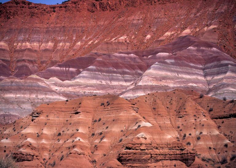
Grand Staircase-Escalante National Monument
Grand Staircase-Escalante National Monument spans nearly 1.9 million acres and features diverse landscapes including cliffs, canyons, and plateaus. It’s a haven for hiking, camping, and exploring unique geological formations. Access Information: Visitor Centers: Located in Escalante, Kanab, and Big Water Phone: (435) 826-5499 (Escalante Interagency Visitor Center) Parking: Available at various trailheads and visitor centers Visit Website
Escalante Petrified Forest State Park
Escalante Petrified Forest State Park showcases ancient petrified wood, fossilized dinosaur bones, and marine fossils over 100 million years old. Visitors can hike the 1.1-mile Petrified Forest Trail for panoramic views and explore the visitor center’s exhibits. Access Information: Address: 710 N. Reservoir Road, Escalante, UT 84726 Park Hours: Summer: 7:00 AM – 10:00 PM; Winter: 8:00 AM – 6:00 PM Phone: (435) 826-4466 Parking: Available at the visitor center…
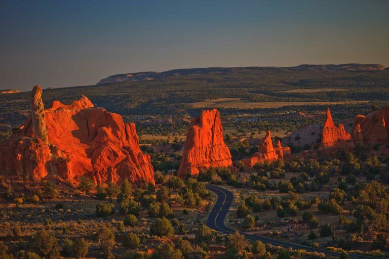
Kodachrome Basin State Park
Kodachrome Basin State Park is famed for its 67 monolithic stone spires, known as sedimentary pipes, set against a backdrop of multicolored sandstone layers. The park offers hiking, horseback riding, and camping opportunities in a serene desert setting. Access Information: Address: Kodachrome Basin State Park, PO Box 180069, Cannonville, UT 84718 Park Hours: Open year-round, 8:00 AM – 6:00 PM Phone: (435) 679-8562 Parking: Available at the visitor center and…
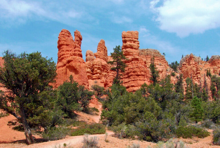
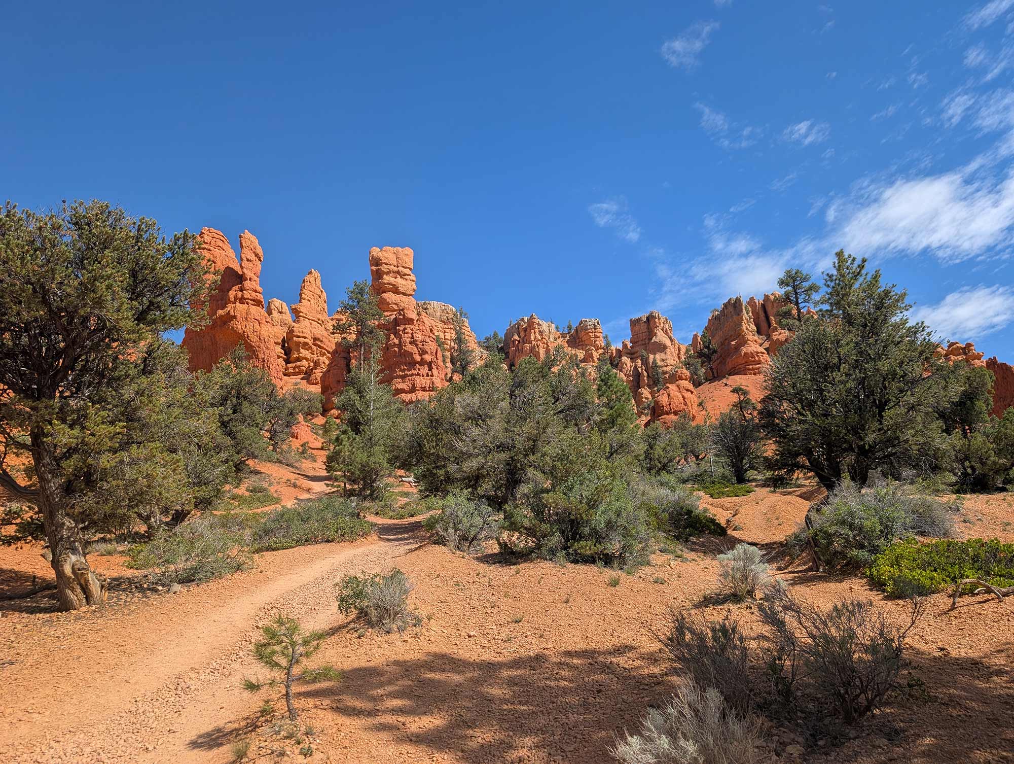
Red Canyon
Red Canyon, located within Dixie National Forest, boasts vibrant red rock formations and is often considered a prelude to Bryce Canyon. The area offers hiking, biking, and ATV trails, as well as a visitor center with interpretive exhibits. Access Information: Address: Red Canyon Visitor Center, 3279 UT-12, Panguitch, UT 84759 Visitor Center Hours: Seasonal; typically open daily from 8:30 AM – 5:00 PM during summer Phone: (435) 676-2676 Parking: Available…
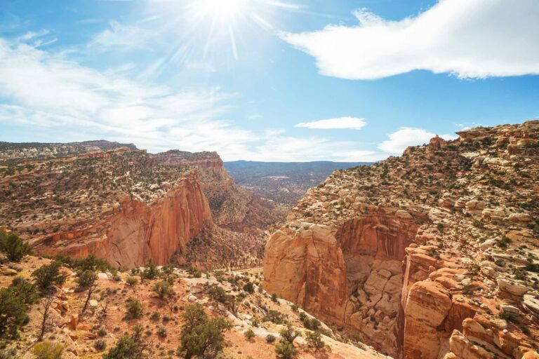
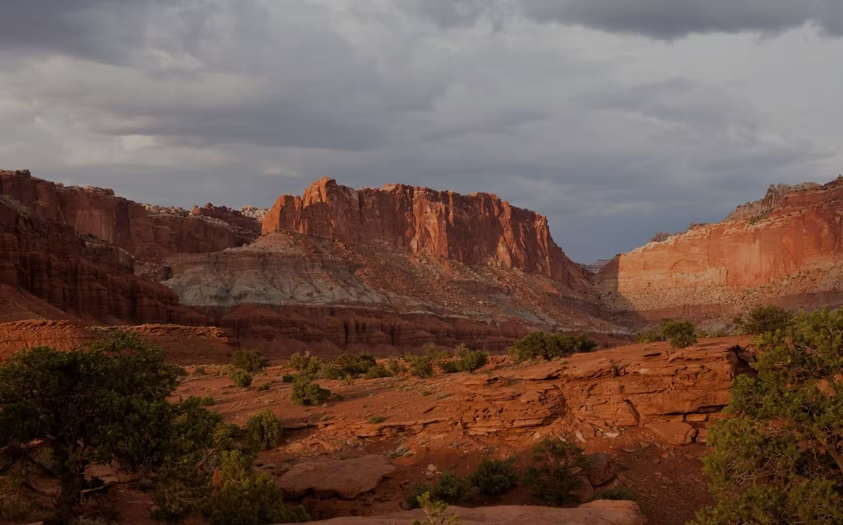
Capitol Reef National Park
Capitol Reef National Park features a stunning array of cliffs, canyons, domes, and bridges in the Waterpocket Fold, a nearly 100-mile-long warp in the Earth’s crust. The park offers hiking, scenic drives, and a glimpse into the area’s rich cultural history. Access Information: Address: HC 70, Box 15, Torrey, UT 84775 Visitor Center Hours: Open year-round; hours vary seasonally Phone: (435) 425-3791 Parking: Available at the visitor center and trailheads;…