Escalante
adventure guide
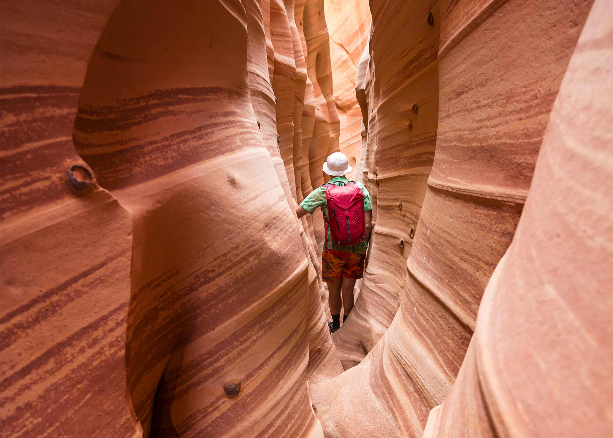
Slot Canyons
Zebra Slot Canyon
Zebra Slot Canyon is known for its stunning pink-and-red striped walls. It’s a tight and often muddy canyon that requires some effort to reach—but the striking visuals make it a favorite among photographers and experienced hikers. Access Information: Trailhead: Hole-in-the-Rock Road, ~7.8 miles south of UT-12 Coordinates: 37.6911° N, 111.4361° W Hike Distance: ~5.2 miles round trip Access: No shade or water; avoid in high temps Phone: (435) 826-5499
Show details
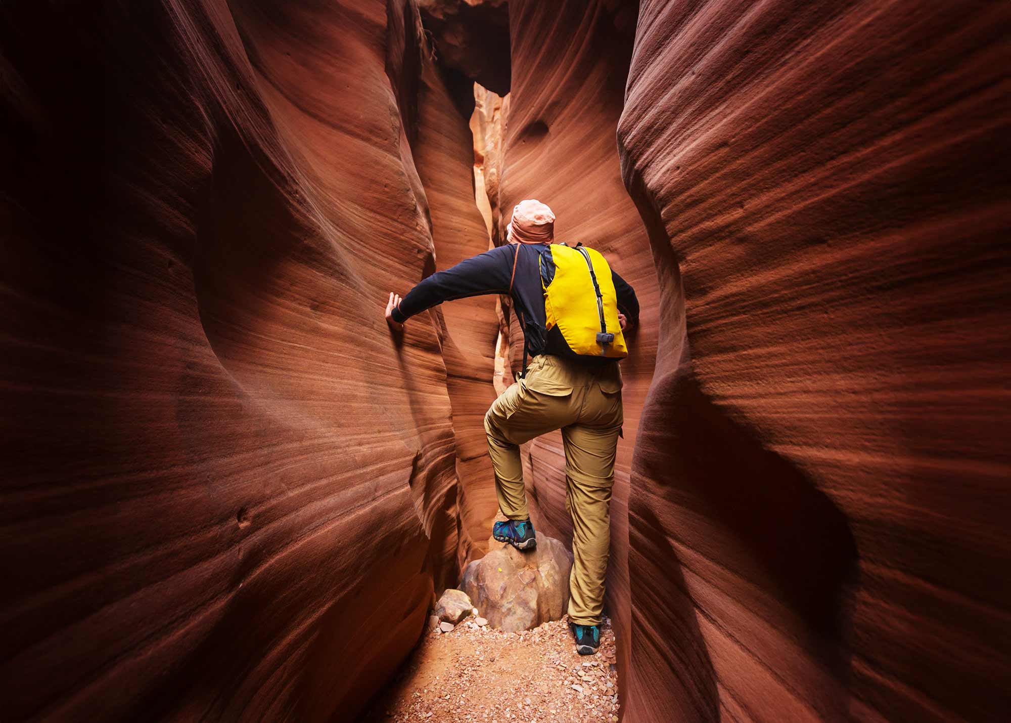
Slot Canyons
Spooky Gulch
Spooky Gulch earns its name with passages so narrow they barely fit a backpack. Often paired with Peek-a-Boo Gulch for a loop, it’s one of the tightest, most thrilling hikes in Escalante’s canyon country. Access Information: Trailhead: Dry Fork Trailhead, off Hole-in-the-Rock Road Coordinates: 37.4708° N, 111.2210° W Hike Distance: ~3.5-mile loop with Peek-a-Boo Access: High-clearance vehicle recommended Phone: (435) 826-5499
Show details
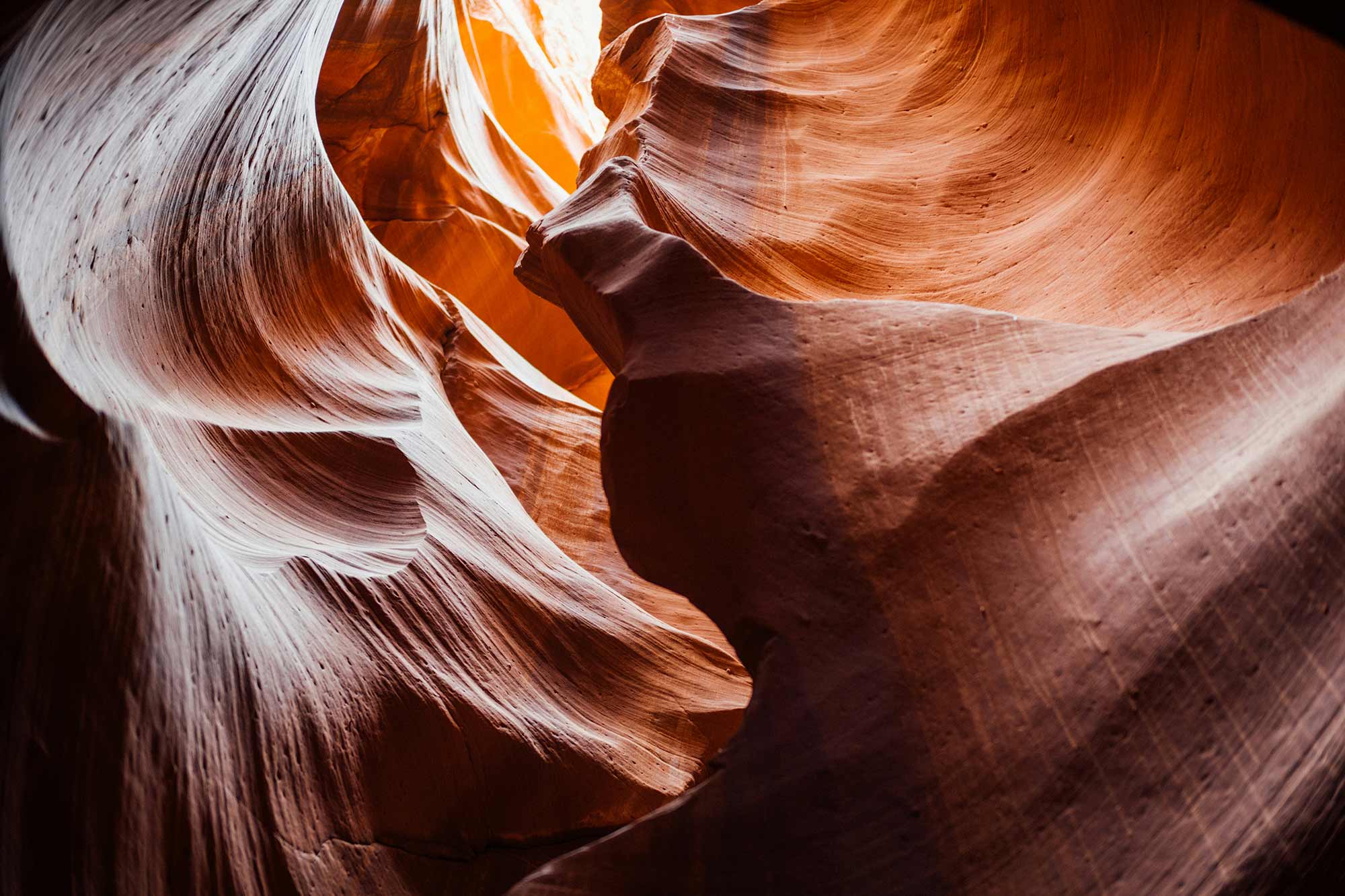
Slot Canyons
Peek-a-Boo Gulch
Peek-a-Boo Gulch is one of the most beloved slot canyons in the Grand Staircase-Escalante region. With tight passages, wavy red rock, and short scrambles, it offers a fun and adventurous hike. Many hikers pair it with nearby Spooky Gulch for a loop. Access Information: Trailhead: Dry Fork Trailhead, off Hole-in-the-Rock Road (approx. 26 miles from Escalante) Coordinates: 37.4732° N, 111.2195° W Hike Distance: ~3.5-mile loop with Spooky Access: Rough dirt...
Show details
Slot Canyons
Cottonwood Narrows
Cottonwood Narrows is a scenic slot canyon accessible from Cottonwood Canyon Road. The easy hike through towering sandstone walls is suitable for families and offers a glimpse into the area’s geological wonders. Access Information: Trailhead: Approximately 20.5 miles south of Cannonville on Cottonwood Canyon Road Coordinates: 37.3993° N, 111.8508° W Hike Distance: 3.3 to 4.5 miles round trip Access: 2WD accessible in dry conditions; impassable when wet Phone: (435) 826-5499...
Show details

Arches
Sam Pollock Arch
Sam Pollock Arch is a secluded sandstone arch located in a remote canyon off Hackberry Canyon. The challenging hike involves boulder scrambling and offers a sense of discovery for intrepid explorers. Access Information: Trailhead: Hackberry Canyon Trailhead, off Cottonwood Canyon Road Coordinates: 37.3139° N, 111.9435° W Hike Distance: Approximately 6 miles one way Access: Difficult hike with route-finding; GPS recommended Phone: (435) 826-5499 (Escalante Interagency Visitor Center)
Show details
Scenic Drives
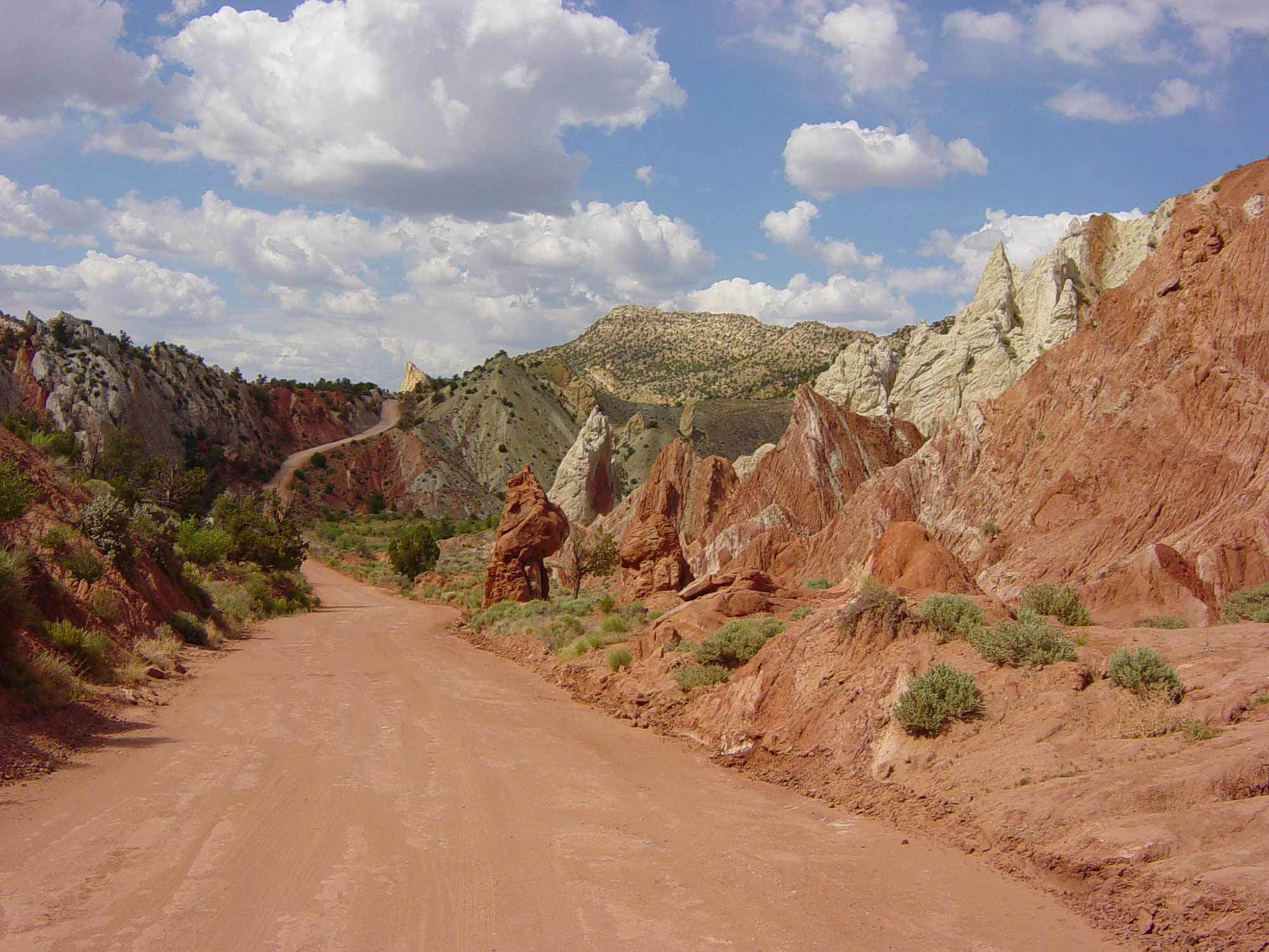
Cottonwood Canyon Road
Cottonwood Canyon Road is a 47-mile scenic backway connecting UT-12 near Cannonville to US-89. The route traverses colorful canyons, offering access to slot canyons, arches, and panoramic vistas. Access Information: Northern Terminus: Cannonville, UT Southern Terminus: Near milepost 18 on US-89 Road Conditions: Unpaved; impassable when wet Access: High-clearance vehicle recommended; check weather conditions Phone: (435) 826-5499 (Escalante Interagency Visitor Center)
Show details

Arches
Phipps Arch
Phipps Arch is a massive sandstone arch perched high above Phipps Wash in Grand Staircase-Escalante National Monument. The challenging hike offers solitude and panoramic views of the surrounding canyons. Access Information: Trailhead: Escalante River Trailhead, 14.6 miles south of the UT-12/Burr Trail Road junction Coordinates: 37.7390° N, 111.4240° W Hike Distance: Approximately 8.8 miles round trip Access: Moderate to strenuous hike; river crossings required Phone: (435) 826-5499 (Escalante Interagency Visitor...
Show details
Unique Formations
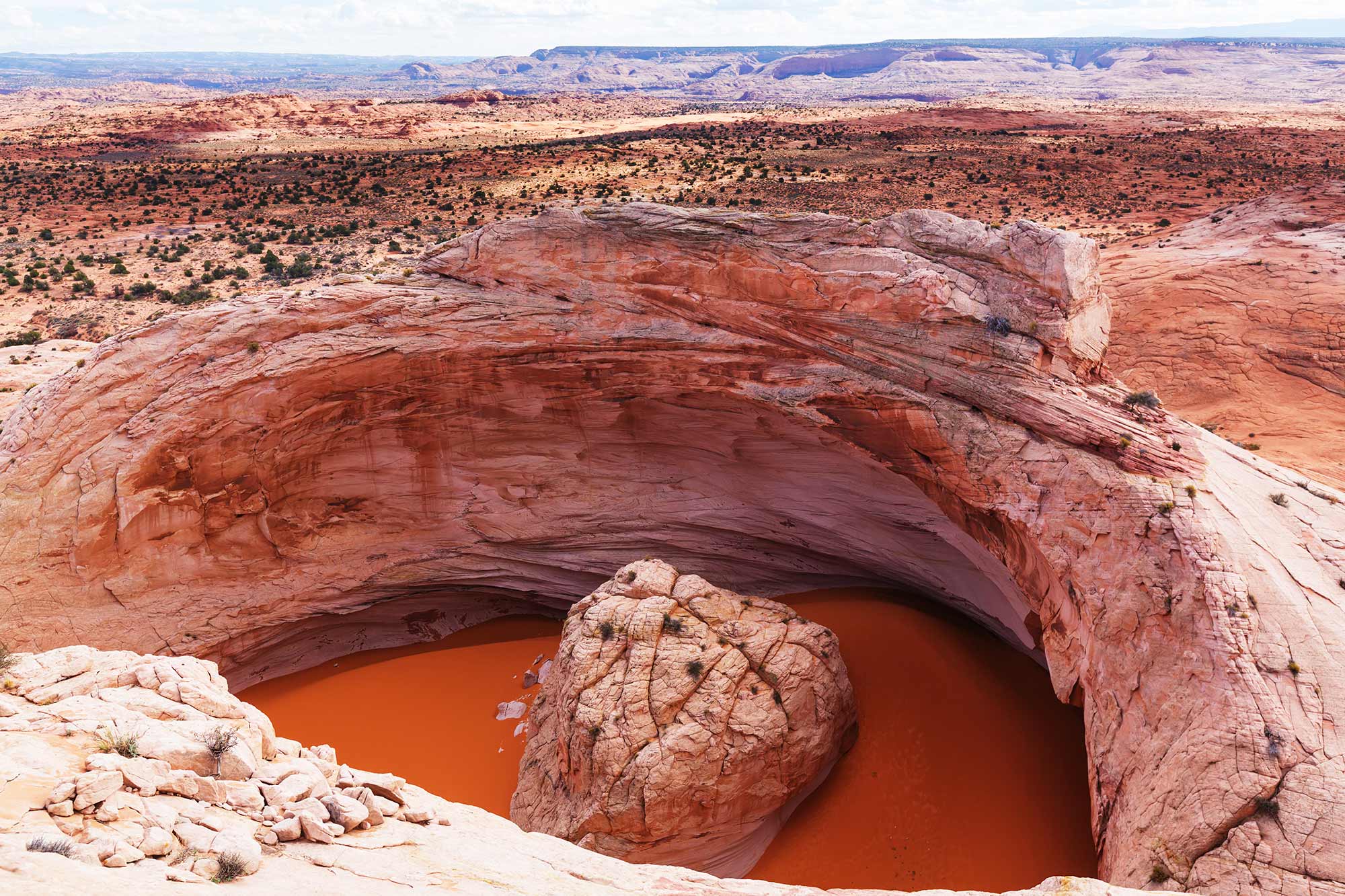
Cosmic Ashtray
The Cosmic Ashtray, also known as The Volcano, is a unique sandstone formation resembling a giant bowl with a central rock “island.” Its remote location and surreal appearance make it a coveted destination for adventurous hikers. Access Information: Trailhead: Spencer Flat Road, approximately 9.5 miles east of Escalante on UT-12 Coordinates: 37.7431° N, 111.4480° W Hike Distance: Approximately 8.3 miles round trip Access: High-clearance vehicle recommended; GPS navigation essential Phone:...
Show details
Arches
Broken Bow Arch
Broken Bow Arch is a striking natural arch spanning nearly 100 feet, located in Willow Gulch. The 4-mile round-trip hike offers scenic views of towering sandstone walls and a chance to explore a serene desert canyon. Access Information: Trailhead: Willow Gulch Trailhead, accessed via Hole-in-the-Rock Road Coordinates: 37.3249° N, 111.0227° W Access: 4-mile round-trip hike; trail may involve stream crossings Phone: (435) 826-5499 (Escalante Interagency Visitor Center)
Show details

Arches
Stevens Arch
Stevens Arch is a massive natural arch spanning 220 feet, perched high above the Escalante River near the confluence with Coyote Gulch. Its remote location offers solitude and breathtaking views, making it a rewarding destination for experienced hikers. Access Information: Trailhead: Crack-in-the-Wall Trailhead, accessed via Hole-in-the-Rock Road Coordinates: 37.3739° N, 111.0342° W Access: Approximately 8-mile round-trip hike with 1,500 ft elevation gain Phone: (435) 826-5499 (Escalante Interagency Visitor Center)
Show details
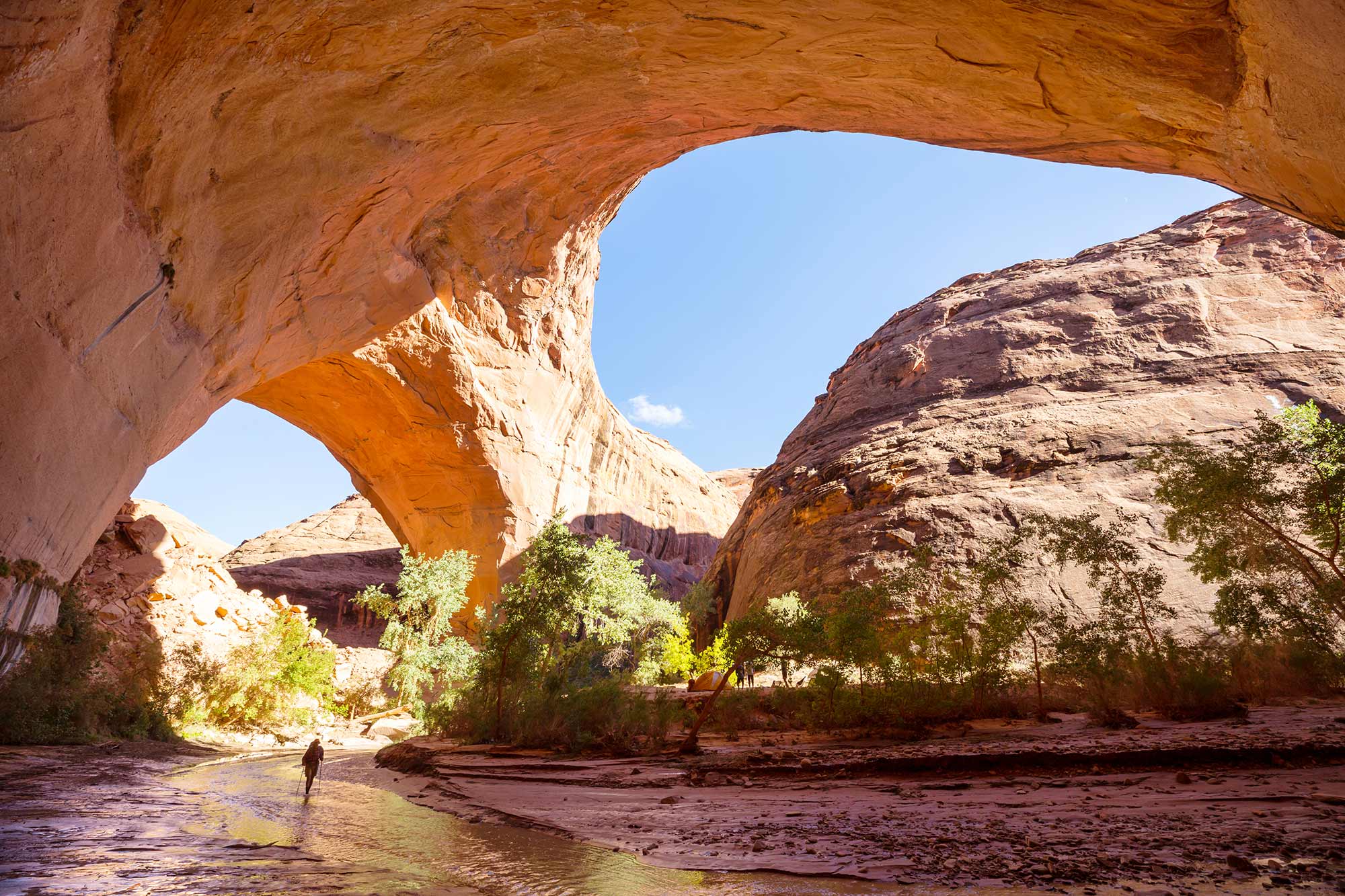
Arches
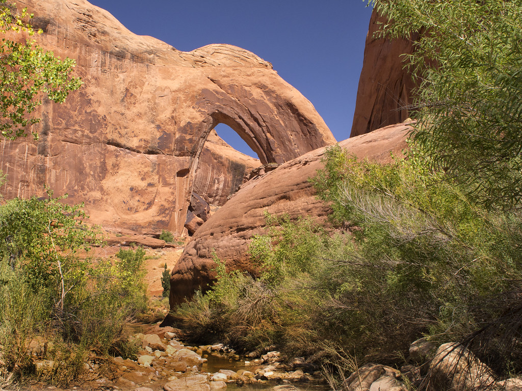
Jacob Hamblin Arch
Jacob Hamblin Arch is a massive sandstone arch located in Coyote Gulch, known for its impressive span and picturesque setting. It’s a popular destination for backpackers exploring the Escalante River region. Access Information: Location: Coyote Gulch, Grand Staircase-Escalante National Monument Coordinates: 37.3822° N, 111.0483° W Access: Accessible via a multi-day backpacking trip; permits required Phone: (435) 826-5499 (Escalante Interagency Visitor Center) Visit Website
Show details
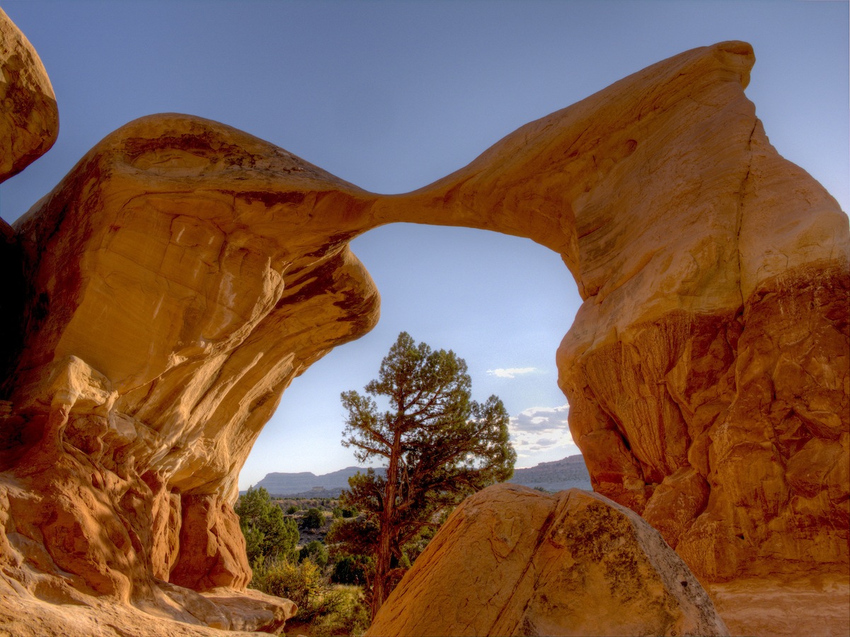
![Cedar Wash Arch]()
Arches
Cedar Wash Arch
Cedar Wash Arch is a natural sandstone arch situated above a scenic wash, offering visitors a short hike with rewarding views. The trail provides a peaceful experience away from more crowded attractions. Access Information: Location: Southeast of Escalante, Utah Directions: From Escalante, drive east on Highway 12 for 4.9 miles to Hole-in-the-Rock Road. Turn right and drive 3.4 miles to Cedar Wash Road. Turn right and continue 3.6 miles to...
Show details
Unique Formations
Big Horn Canyon
Big Horn Canyon offers a moderately challenging 7.8-mile hike through crossbedded sandstone formations. It’s a less-traveled trail providing solitude and unique geological features. Access Information: Trailhead: Old Sheffield Road, approximately 9.5 miles east of Escalante on UT-12 Parking: Limited space available at the trailhead Phone: (435) 826-5499 (Escalante Interagency Visitor Center) Visit Website
Show details
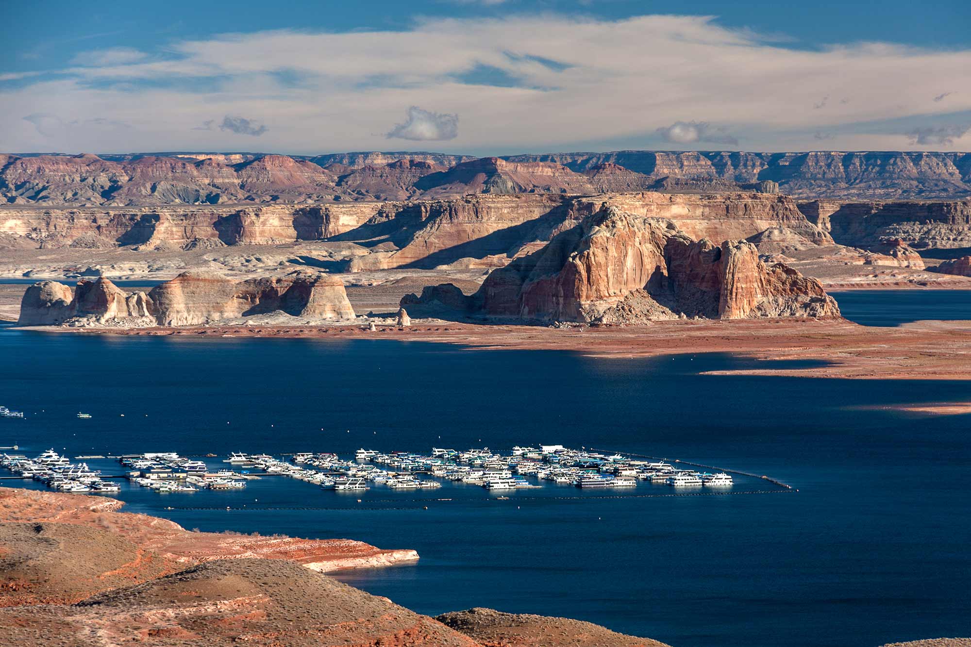
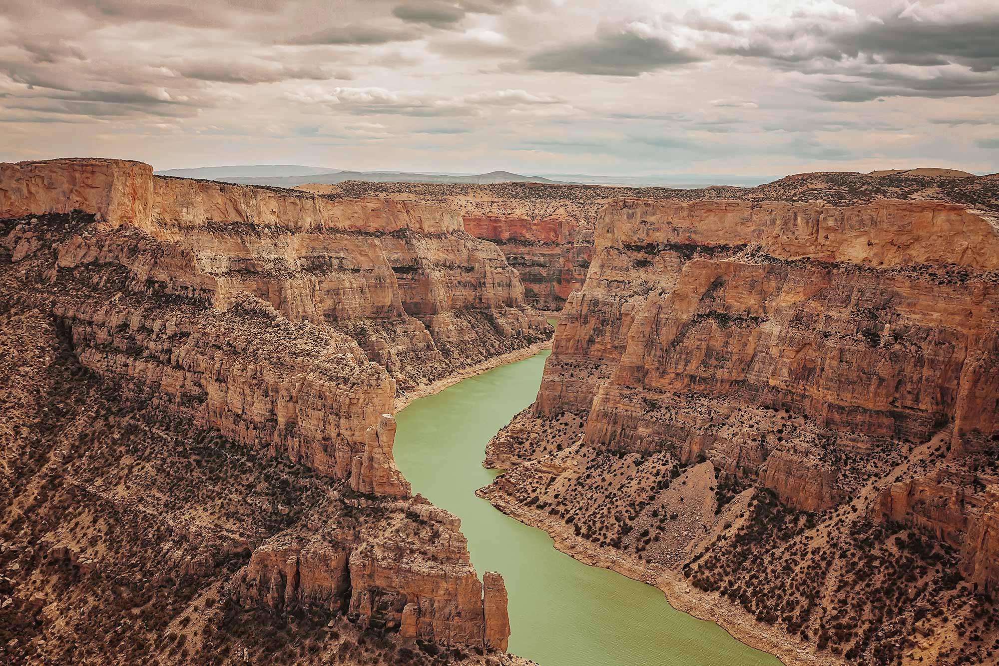
Waterfalls & Rivers
Lake Powell
Lake Powell is a vast reservoir on the Colorado River, offering over 2,000 miles of shoreline. It’s a haven for boating, fishing, and exploring hidden canyons, with numerous marinas and recreational facilities along its expanse. Access Information: Major Marinas: Wahweap (AZ), Bullfrog (UT), Halls Crossing (UT) Coordinates: 36.9382° N, 111.4840° W Access: Accessible via multiple entry points in Utah and Arizona Phone: (928) 608-6200 (Glen Canyon National Recreation Area) Visit...
Show details
Arches
Metate Arch
Metate Arch is a delicate sandstone formation located within the Devil’s Garden area of Grand Staircase-Escalante National Monument. Its graceful curve and unique shape make it a favorite among photographers and nature enthusiasts. Access Information: Location: Devil’s Garden, Grand Staircase-Escalante National Monument Directions: From Escalante, drive east on Highway 12 for 5 miles. Turn right onto Hole-in-the-Rock Road and continue for 12.2 miles. Turn right at the signed Devil’s Garden...
Show details
National Parks
Grand Staircase-Escalante National Monument
Grand Staircase-Escalante National Monument spans nearly 1.9 million acres and features diverse landscapes including cliffs, canyons, and plateaus. It’s a haven for hiking, camping, and exploring unique geological formations. Access Information: Visitor Centers: Located in Escalante, Kanab, and Big Water Phone: (435) 826-5499 (Escalante Interagency Visitor Center) Parking: Available at various trailheads and visitor centers Visit Website
Show details
National Parks
Escalante Petrified Forest State Park
Escalante Petrified Forest State Park showcases ancient petrified wood, fossilized dinosaur bones, and marine fossils over 100 million years old. Visitors can hike the 1.1-mile Petrified Forest Trail for panoramic views and explore the visitor center’s exhibits. Access Information: Address: 710 N. Reservoir Road, Escalante, UT 84726 Park Hours: Summer: 7:00 AM – 10:00 PM; Winter: 8:00 AM – 6:00 PM Phone: (435) 826-4466 Parking: Available at the visitor center...
Show details

National Parks
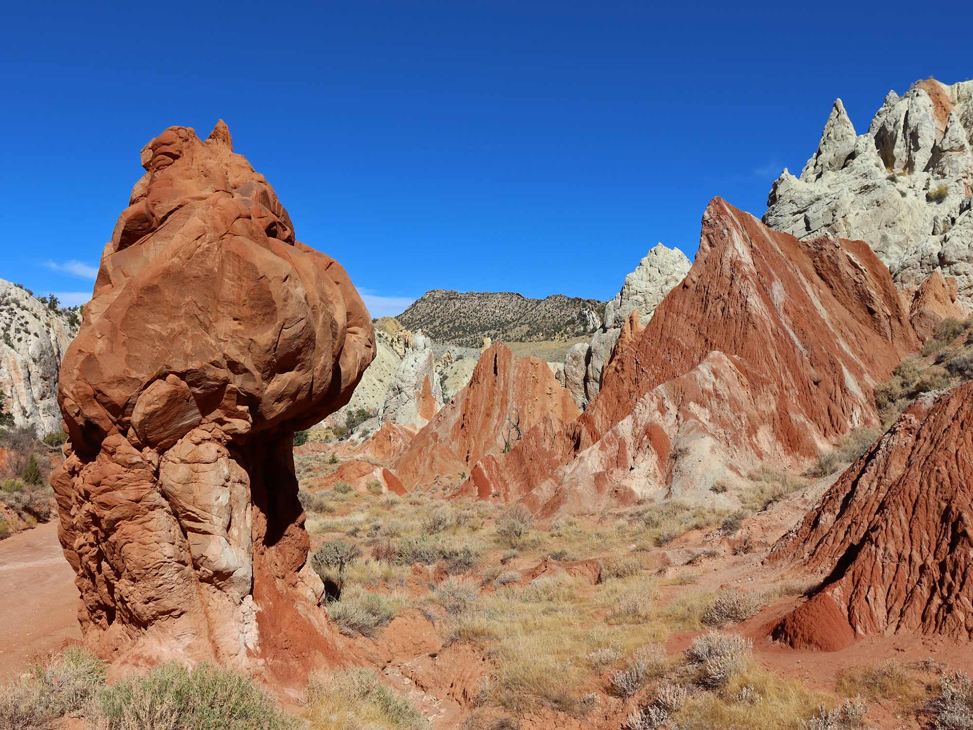
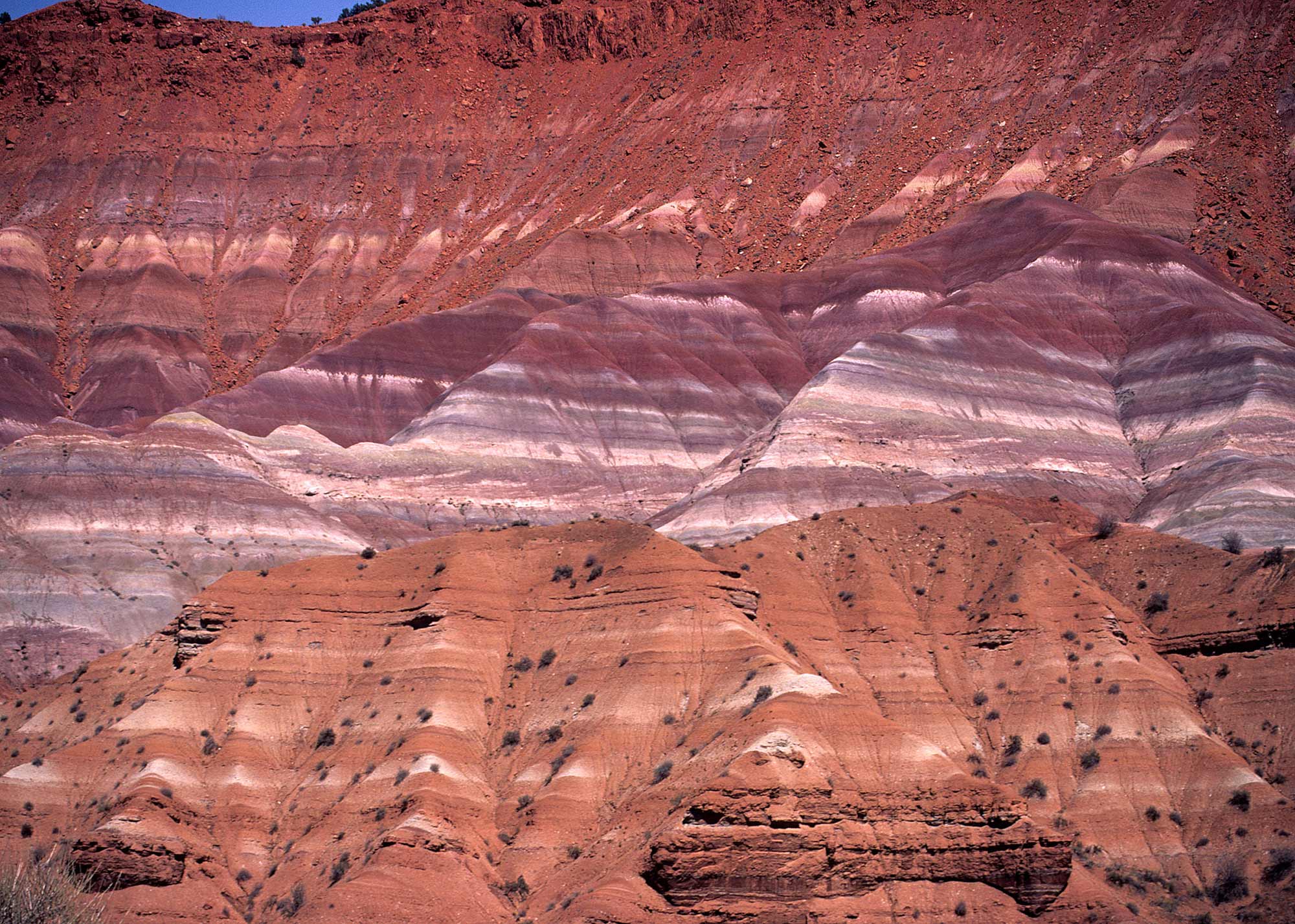
Kodachrome Basin State Park
Kodachrome Basin State Park is famed for its 67 monolithic stone spires, known as sedimentary pipes, set against a backdrop of multicolored sandstone layers. The park offers hiking, horseback riding, and camping opportunities in a serene desert setting. Access Information: Address: Kodachrome Basin State Park, PO Box 180069, Cannonville, UT 84718 Park Hours: Open year-round, 8:00 AM – 6:00 PM Phone: (435) 679-8562 Parking: Available at the visitor center and...
Show details
National Parks
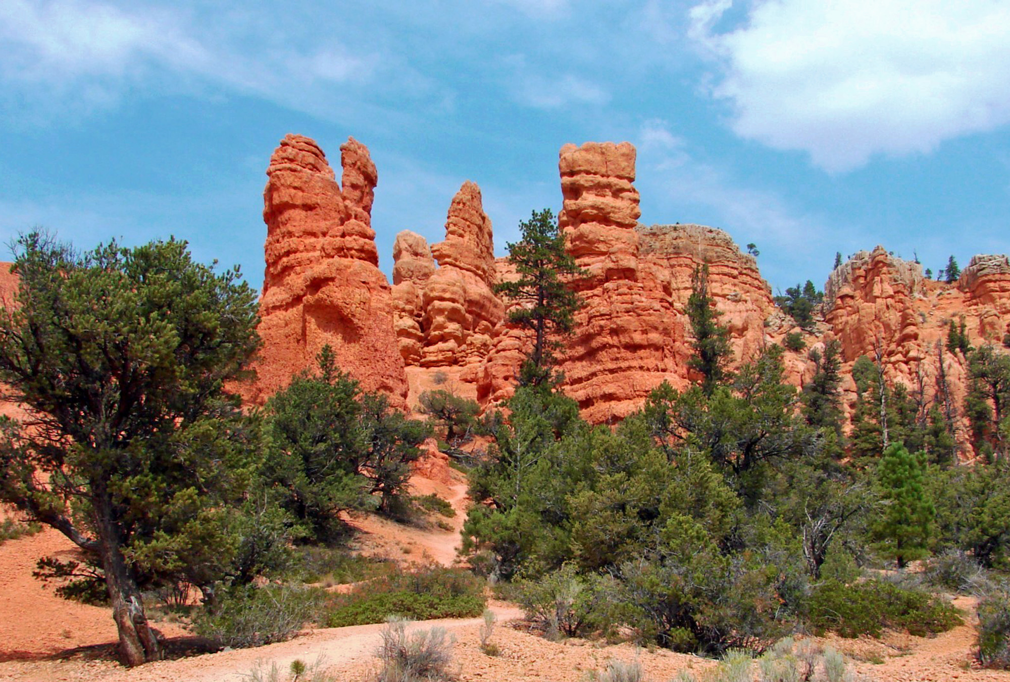
Red Canyon
Red Canyon, located within Dixie National Forest, boasts vibrant red rock formations and is often considered a prelude to Bryce Canyon. The area offers hiking, biking, and ATV trails, as well as a visitor center with interpretive exhibits. Access Information: Address: Red Canyon Visitor Center, 3279 UT-12, Panguitch, UT 84759 Visitor Center Hours: Seasonal; typically open daily from 8:30 AM – 5:00 PM during summer Phone: (435) 676-2676 Parking: Available...
Show details
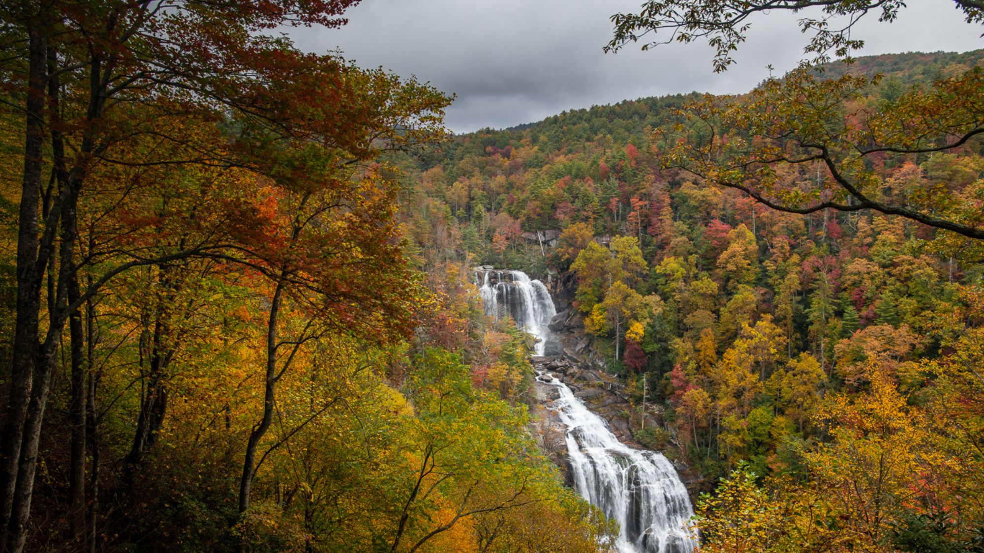
Waterfalls & Rivers
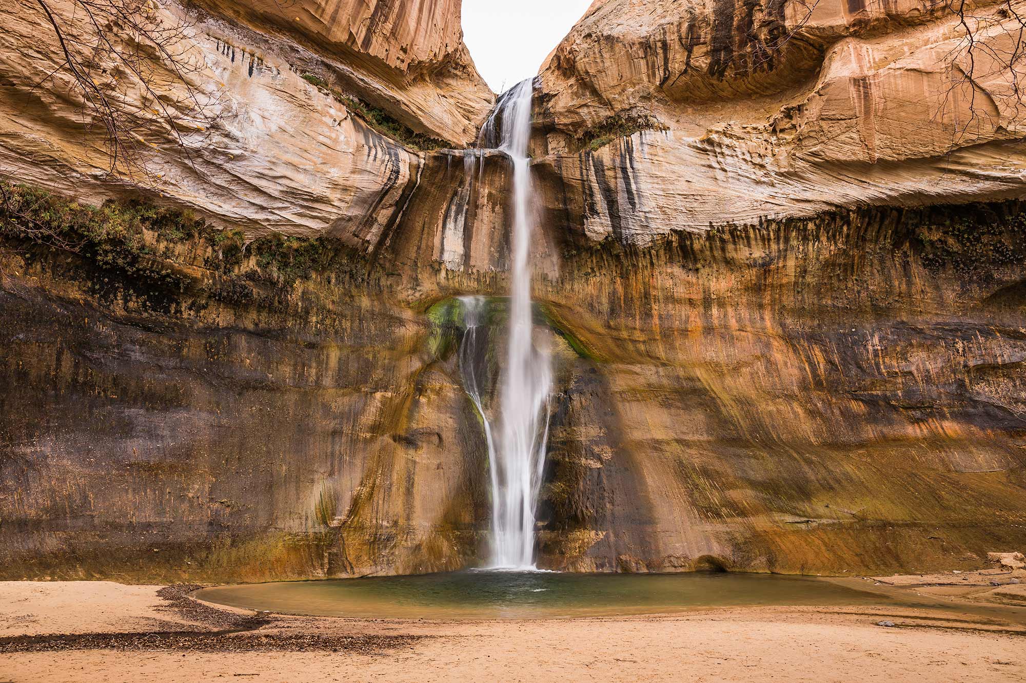
Lower Calf Creek Falls
Lower Calf Creek Falls is a 126-foot waterfall nestled in the Grand Staircase-Escalante National Monument. The 6-mile round-trip hike to the falls offers views of sandstone cliffs, beaver ponds, and ancient petroglyphs, culminating in a refreshing pool at the base of the falls. Access Information: Trailhead Location: Calf Creek Recreation Area, approximately 15 miles east of Escalante on UT-12 Coordinates: 37.7988° N, 111.4121° W Phone: (435) 826-5499 Parking: Available at...
Show details
National Parks
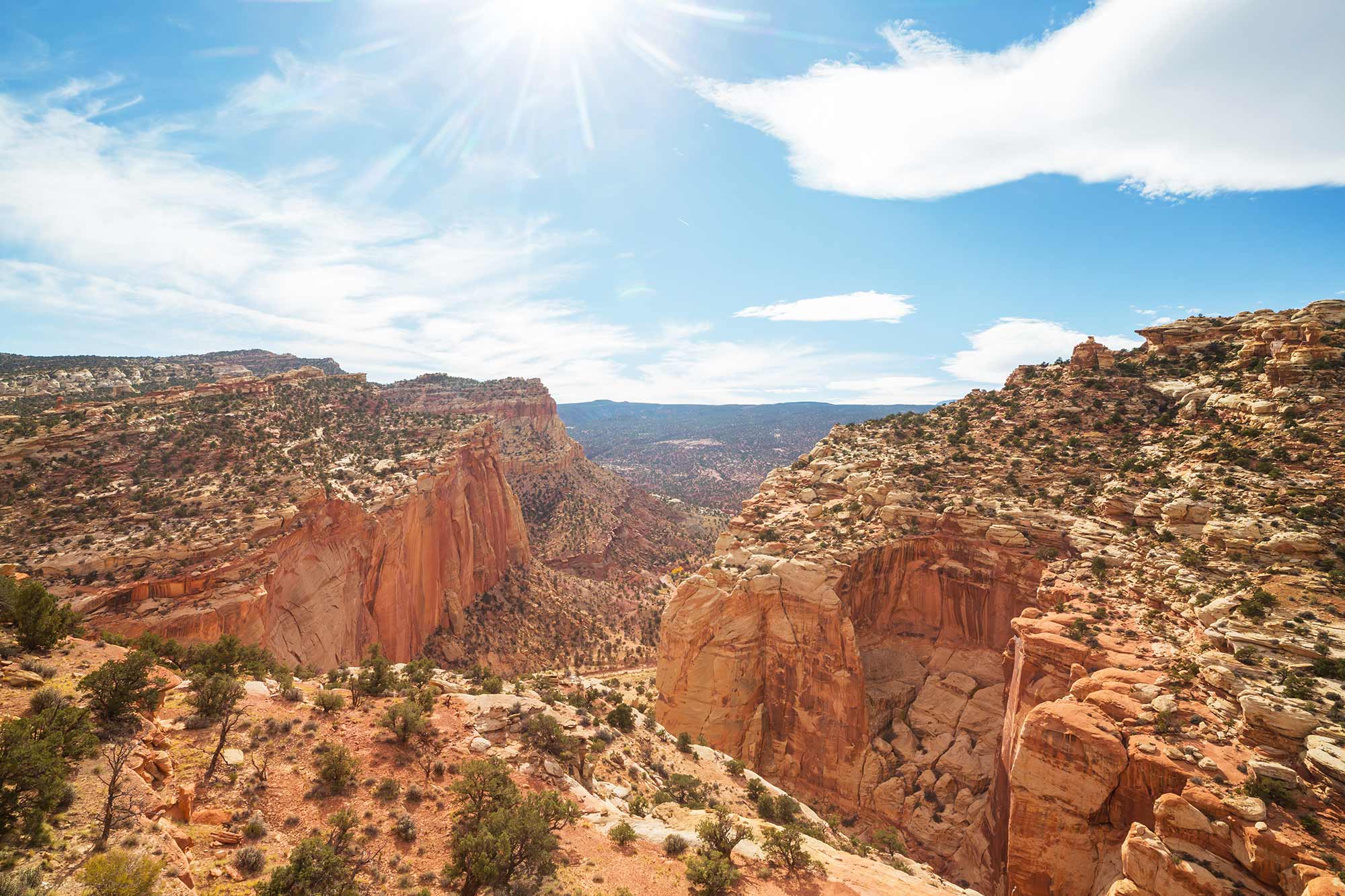
Capitol Reef National Park
Capitol Reef National Park features a stunning array of cliffs, canyons, domes, and bridges in the Waterpocket Fold, a nearly 100-mile-long warp in the Earth’s crust. The park offers hiking, scenic drives, and a glimpse into the area’s rich cultural history. Access Information: Address: HC 70, Box 15, Torrey, UT 84775 Visitor Center Hours: Open year-round; hours vary seasonally Phone: (435) 425-3791 Parking: Available at the visitor center and trailheads;...
Show details
National Parks
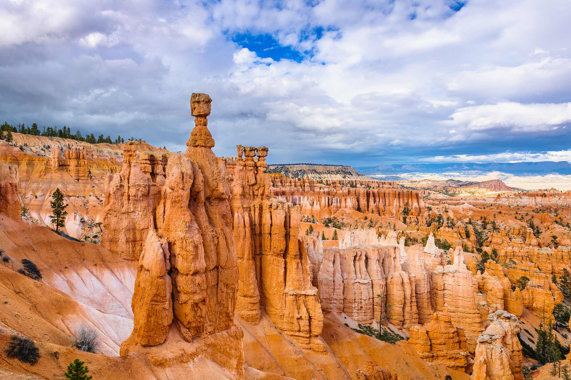
Bryce Canyon National Park
Bryce Canyon National Park is famous for its unique geological structures called hoodoos—tall, thin spires of rock that protrude from the bottom of arid basins. Visitors can enjoy scenic vistas, hiking trails, and stargazing opportunities in this high-altitude park. Access Information: Address: Highway 63, Bryce, UT 84764 Visitor Center Hours: Varies seasonally; typically 8:00 AM – 8:00 PM in summer Phone: (435) 834-5322 Parking: Available at the visitor center and...
Show details