Sam Pollock Arch is a secluded sandstone arch located in a remote canyon off Hackberry Canyon. The challenging hike involves boulder scrambling and offers a sense of discovery for intrepid explorers. Access Information: Trailhead: Hackberry Canyon Trailhead, off Cottonwood Canyon Road Coordinates: 37.3139° N, 111.9435° W Hike Distance: Approximately 6 miles one way Access: Difficult hike with route-finding; GPS recommended Phone: (435) 826-5499 (Escalante Interagency Visitor Center)Show details
Arches
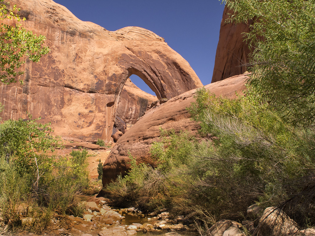
Phipps Arch
Phipps Arch is a massive sandstone arch perched high above Phipps Wash in Grand Staircase-Escalante National Monument. The challenging hike offers solitude and panoramic views of the surrounding canyons. Access Information: Trailhead: Escalante River Trailhead, 14.6 miles south of the UT-12/Burr Trail Road junction Coordinates: 37.7390° N, 111.4240° W Hike Distance: Approximately 8.8 miles round trip Access: Moderate to strenuous hike; river crossings required Phone: (435) 826-5499 (Escalante Interagency Visitor...Show details
Arches
Broken Bow Arch
Broken Bow Arch is a striking natural arch spanning nearly 100 feet, located in Willow Gulch. The 4-mile round-trip hike offers scenic views of towering sandstone walls and a chance to explore a serene desert canyon. Access Information: Trailhead: Willow Gulch Trailhead, accessed via Hole-in-the-Rock Road Coordinates: 37.3249° N, 111.0227° W Access: 4-mile round-trip hike; trail may involve stream crossings Phone: (435) 826-5499 (Escalante Interagency Visitor Center)Show details
Arches
Stevens Arch
Stevens Arch is a massive natural arch spanning 220 feet, perched high above the Escalante River near the confluence with Coyote Gulch. Its remote location offers solitude and breathtaking views, making it a rewarding destination for experienced hikers. Access Information: Trailhead: Crack-in-the-Wall Trailhead, accessed via Hole-in-the-Rock Road Coordinates: 37.3739° N, 111.0342° W Access: Approximately 8-mile round-trip hike with 1,500 ft elevation gain Phone: (435) 826-5499 (Escalante Interagency Visitor Center)Show details
Arches
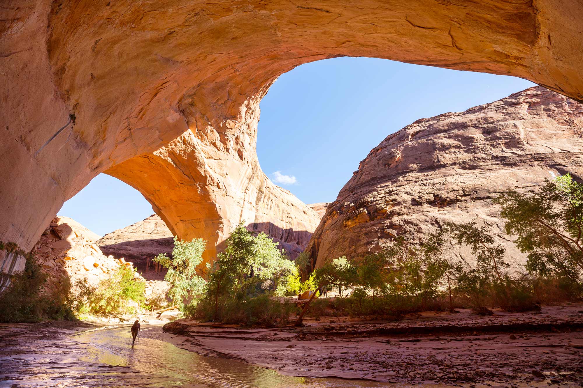
Jacob Hamblin Arch
Jacob Hamblin Arch is a massive sandstone arch located in Coyote Gulch, known for its impressive span and picturesque setting. It’s a popular destination for backpackers exploring the Escalante River region. Access Information: Location: Coyote Gulch, Grand Staircase-Escalante National Monument Coordinates: 37.3822° N, 111.0483° W Access: Accessible via a multi-day backpacking trip; permits required Phone: (435) 826-5499 (Escalante Interagency Visitor Center) Visit WebsiteShow details
Arches
Cedar Wash Arch
Cedar Wash Arch is a natural sandstone arch situated above a scenic wash, offering visitors a short hike with rewarding views. The trail provides a peaceful experience away from more crowded attractions. Access Information: Location: Southeast of Escalante, Utah Directions: From Escalante, drive east on Highway 12 for 4.9 miles to Hole-in-the-Rock Road. Turn right and drive 3.4 miles to Cedar Wash Road. Turn right and continue 3.6 miles to...Show details
Arches
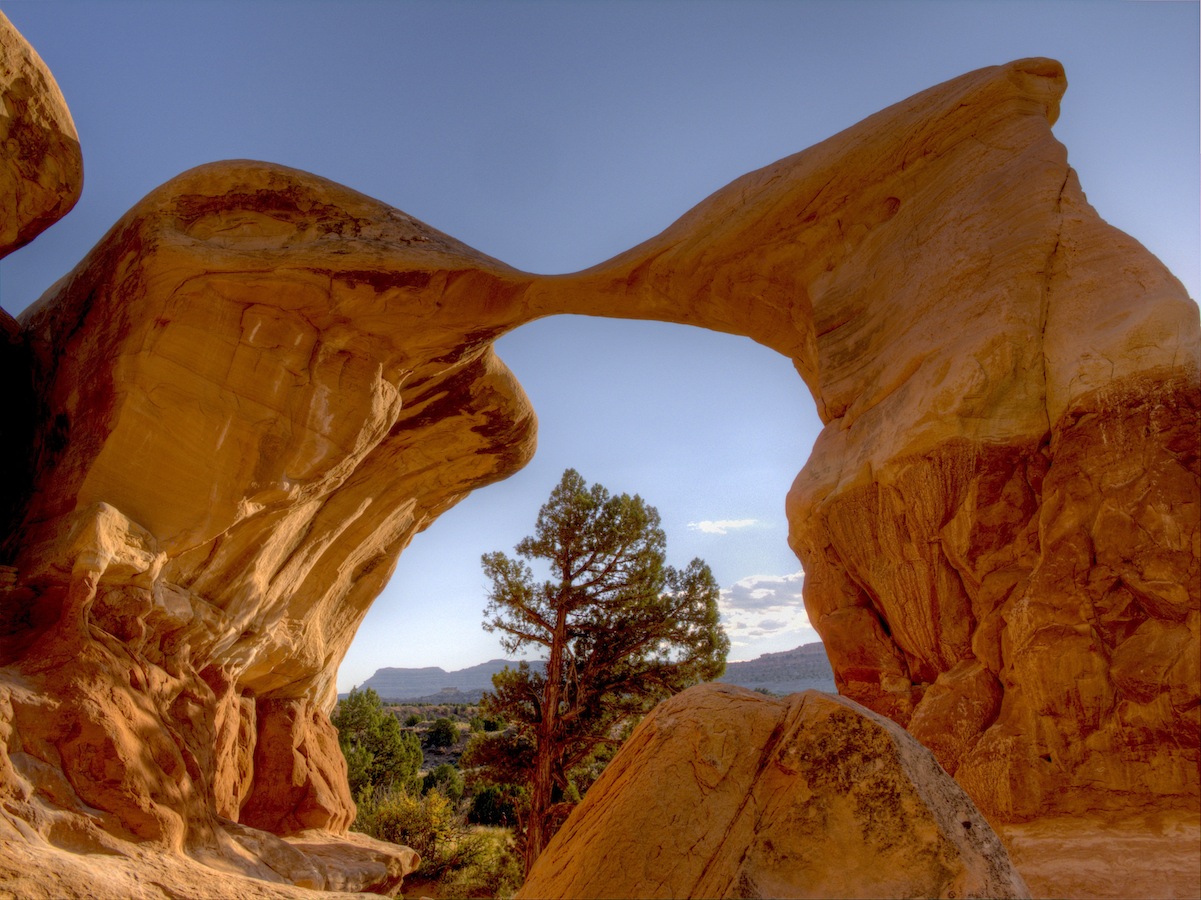
Metate Arch
Metate Arch is a delicate sandstone formation located within the Devil’s Garden area of Grand Staircase-Escalante National Monument. Its graceful curve and unique shape make it a favorite among photographers and nature enthusiasts. Access Information: Location: Devil’s Garden, Grand Staircase-Escalante National Monument Directions: From Escalante, drive east on Highway 12 for 5 miles. Turn right onto Hole-in-the-Rock Road and continue for 12.2 miles. Turn right at the signed Devil’s Garden...Show details